
I’ve been using Google maps quite a bit in the last few months to get me from point A to point B in cities that I don’t know too well.
Most of the time the maps are accurate and the directions are good.
So what about this one?
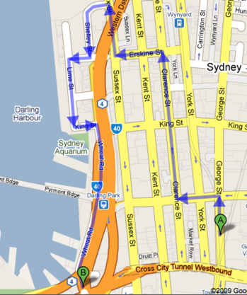
Granted, there could be some very good reasons why Google wants to route me by this rather circuitous route (and yes I did specify “walking”, so it’s not a “one way system” issue) but it still strikes me as odd ..
So much for the shortest distance between two points being a straight line …


Looking at streetview the “Orange road” is raised above street level. So perhaps you have to take the circular route to get around it?
You could be right, but I guess the easiest thing is for me to actually try it on foot and see what happens 🙂
how does it fare in http://www.openrouteservice.org/ ?
also http://yournavigation.org/ should fare better too
You should look at the new motorway between Nenagh and Limerick. It’s on Google Maps, but not due to open until December 2009 (due to seven month delay).
That´s just because Google has gathered so much personal information about you that it knows there are a number of t-shirts, movie memorabilia and tech gadgets shops on that route that you cannot absolutely miss 😉
I’m guessing that they haven’t mapped the footbridge (under the monorail) which is why they are sending you the long way. A little odd, given the Google Maps dev team looks straight down onto this! 🙂